Description
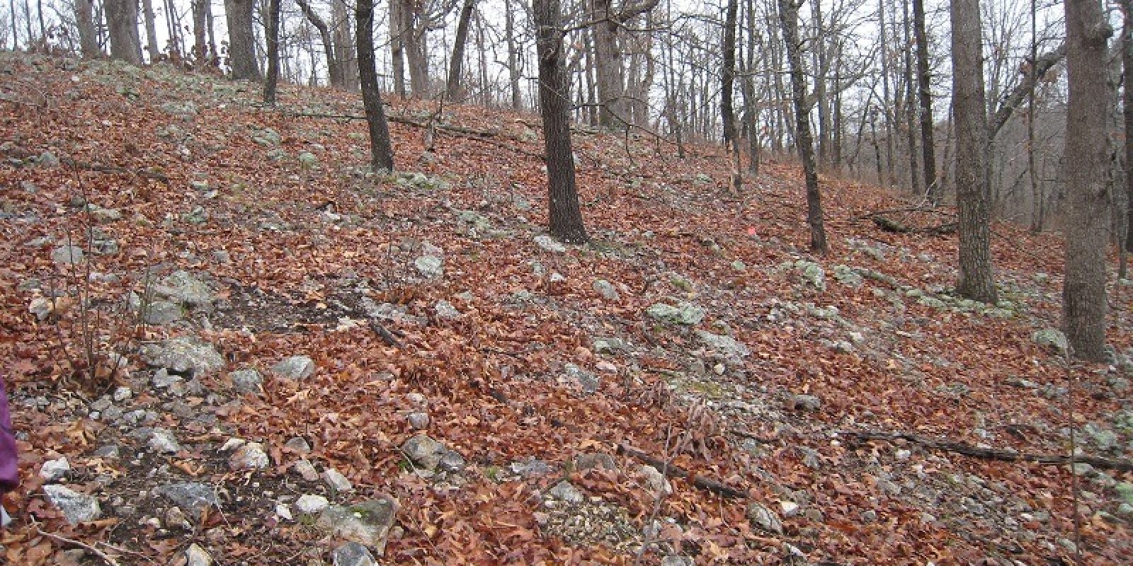
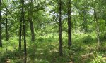
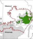
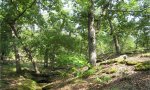
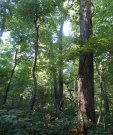
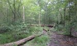
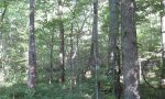
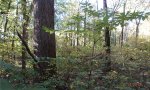
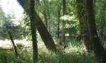
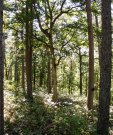
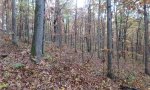
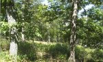
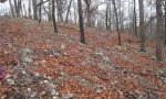
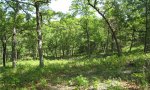
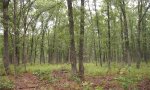
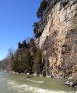
The Ozark Highland constitutes the Salem Plateau of the Ozark Uplift. Elevation ranges from about 300 feet on the southeast edge of the Ozark escarpment, to about 1,600 feet in the west, adjacent to the Burlington Escarpment of the Springfield Plateau. The underlying bedrock is mainly horizontally bedded Ordovician-aged dolomites and sandstones that dip gently away from the uplift apex in southeast Missouri. Cambrian dolomites are exposed on deeply dissected hillslopes. In some places, Pennsylvanian and Mississippian sediments overlie the plateau. Relief varies, from the gently rolling central plateau areas to deeply dissected hillslopes associated with drainageways such as the Buffalo, Current, Eleven Point and White Rivers.
Key publications
Next steps
-
1
Select an ecological site
Select an ecological site using the list, keys, photos, briefcase, or quick search option located on this page. -
2
Explore the ecological site description
Next, learn more about the selected ecological site and its characteristic dynamics by browsing the ecological site description and exploring alternative state and transition model formats.
Ecological site list
-
i
Key Characteristics
- Upland Summits, Shoulders or Backslopes [NOT Upland Drainageways, Sinkholes, Footslopes & High Terraces, Terraces & Floodplain Steps, or Low Floodplains]
- Bedrock >20”
- Alfisols or Ultisols, not in Mollic subgroups
- >15% slope
- Residuum
- Cherty dolomite residuum, or cherty slope alluvium
- <12” loess
- Alfisols
- Bedrock >40”; none
- North, East aspects
-
i
Key Characteristics
- Upland Summits, Shoulders or Backslopes [NOT Upland Drainageways, Sinkholes, Footslopes & High Terraces, Terraces & Floodplain Steps, or Low Floodplains]
- Bedrock >20”
- Alfisols or Ultisols, not in Mollic subgroups
- <15% slope
- <12” loess
- Cherty Mudstone residuum or sandstone residuum
- Cherty mudstone residuum
-
i
Key Characteristics
- Upland Summits, Shoulders or Backslopes [NOT Upland Drainageways, Sinkholes, Footslopes & High Terraces, Terraces & Floodplain Steps, or Low Floodplains]
- Bedrock >20”
- Alfisols or Ultisols, not in Mollic subgroups
- <15% slope
- >12” loess
- Fragipan or claypan
- Moderately Well Drained
-
i
Key Characteristics
- Upland Summits, Shoulders or Backslopes [NOT Upland Drainageways, Sinkholes, Footslopes & High Terraces, Terraces & Floodplain Steps, or Low Floodplains]
- Bedrock >20”
- Alfisols or Ultisols, not in Mollic subgroups
- <15% slope
- >12” loess
- No root restriction
- Ultic
-
i
Key Characteristics
- Upland Summits, Shoulders or Backslopes [NOT Upland Drainageways, Sinkholes, Footslopes & High Terraces, Terraces & Floodplain Steps, or Low Floodplains]
- Bedrock >20”
- Alfisols or Ultisols, not in Mollic subgroups
- <15% slope
- >12” loess
- No root restriction
- Alfic
-
i
Key Characteristics
- Upland Summits, Shoulders or Backslopes [NOT Upland Drainageways, Sinkholes, Footslopes & High Terraces, Terraces & Floodplain Steps, or Low Floodplains]
- Bedrock >20”
- Mollisols or Mollic Subgroups
- <12” loess
- <15% slope
- Bedrock 20-40”
-
i
Key Characteristics
- Upland Summits, Shoulders or Backslopes [NOT Upland Drainageways, Sinkholes, Footslopes & High Terraces, Terraces & Floodplain Steps, or Low Floodplains]
- Bedrock >20”
- Mollisols or Mollic Subgroups
- <12” loess
- >15% slope
- North, East aspects
-
i
Key Characteristics
- Upland Summits, Shoulders or Backslopes [NOT Upland Drainageways, Sinkholes, Footslopes & High Terraces, Terraces & Floodplain Steps, or Low Floodplains]
- Bedrock >20”
- Alfisols or Ultisols, not in Mollic subgroups
- <15% slope
- <12” loess
- Dolomite residuum or cherty dolomite residuum
- Cherty dolomite residuum
- Alfisols
- Bedrock >40”; none
-
i
Key Characteristics
- Upland Summits, Shoulders or Backslopes [NOT Upland Drainageways, Sinkholes, Footslopes & High Terraces, Terraces & Floodplain Steps, or Low Floodplains]
- Bedrock >20”
- Alfisols or Ultisols, not in Mollic subgroups
- <15% slope
- <12” loess
- Dolomite residuum or cherty dolomite residuum
- Cherty dolomite residuum
- Ultisols
- Shortleaf Pine not able to regenerate naturally (outside of natural range of Shortleaf Pine)
-
i
Key Characteristics
- Upland Summits, Shoulders or Backslopes [NOT Upland Drainageways, Sinkholes, Footslopes & High Terraces, Terraces & Floodplain Steps, or Low Floodplains]
- Bedrock >20”
- Alfisols or Ultisols, not in Mollic subgroups
- >15% slope
- Residuum
- Cherty dolomite residuum, or cherty slope alluvium
- <12” loess
- Ultisols
- North, East aspects
-
i
Key Characteristics
- Upland Summits, Shoulders or Backslopes [NOT Upland Drainageways, Sinkholes, Footslopes & High Terraces, Terraces & Floodplain Steps, or Low Floodplains]
- Bedrock >20”
- Alfisols or Ultisols, not in Mollic subgroups
- >15% slope
- Residuum
- Cherty dolomite residuum, or cherty slope alluvium
- <12” loess
- Alfisols
- Bedrock 20-40”
- No loess
- North, East aspects
-
i
Key Characteristics
- Upland Summits, Shoulders or Backslopes [NOT Upland Drainageways, Sinkholes, Footslopes & High Terraces, Terraces & Floodplain Steps, or Low Floodplains]
- Bedrock >20”
- Alfisols or Ultisols, not in Mollic subgroups
- <15% slope
- <12” loess
- Dolomite residuum or cherty dolomite residuum
- Dolomite residuum
-
i
Key Characteristics
- Upland Summits, Shoulders or Backslopes [NOT Upland Drainageways, Sinkholes, Footslopes & High Terraces, Terraces & Floodplain Steps, or Low Floodplains]
- Bedrock >20”
- Alfisols or Ultisols, not in Mollic subgroups
- >15% slope
- Residuum
- Cherty dolomite residuum, or cherty slope alluvium
- <12” loess
- Alfisols
- Bedrock 20-40”
- Thin loess
- North, East aspects
-
i
Key Characteristics
- Upland Summits, Shoulders or Backslopes [NOT Upland Drainageways, Sinkholes, Footslopes & High Terraces, Terraces & Floodplain Steps, or Low Floodplains]
- Bedrock >20”
- Alfisols or Ultisols, not in Mollic subgroups
- >15% slope
- Colluvium
-
i
Key Characteristics
- Upland Summits, Shoulders or Backslopes [NOT Upland Drainageways, Sinkholes, Footslopes & High Terraces, Terraces & Floodplain Steps, or Low Floodplains]
- Bedrock >20”
- Alfisols or Ultisols, not in Mollic subgroups
- <15% slope
- <12” loess
- Cherty Mudstone residuum or sandstone residuum
- Sandstone residuum
-
i
Key Characteristics
- Upland Summits, Shoulders or Backslopes [NOT Upland Drainageways, Sinkholes, Footslopes & High Terraces, Terraces & Floodplain Steps, or Low Floodplains]
- Bedrock >20”
- Alfisols or Ultisols, not in Mollic subgroups
- >15% slope
- Residuum
- Cherty dolomite residuum, or cherty slope alluvium
- >12” loess
- North, East aspects
-
i
Key Characteristics
- Upland Drainageways, Sinkholes, Footslopes & High Terraces, Terraces & Floodplain Steps, or Low Floodplains
- Sinkholes, Footslopes & High Terraces, Terraces & Floodplain Steps, or Low Floodplains
- Footslopes & High Terraces, Terraces & Floodplain Steps, or Low Floodplains
- Footslopes & High Terraces [NOT Terraces & Floodplain Steps, or Low Floodplains]
- Alfic & Ultic
- Moderately Well, Well Drained
- Low Available Water Capacity (skeletal or fragipan)
-
i
Key Characteristics
- Upland Drainageways, Sinkholes, Footslopes & High Terraces, Terraces & Floodplain Steps, or Low Floodplains
- Sinkholes, Footslopes & High Terraces, Terraces & Floodplain Steps, or Low Floodplains
- Footslopes & High Terraces, Terraces & Floodplain Steps, or Low Floodplains
- Footslopes & High Terraces [NOT Terraces & Floodplain Steps, or Low Floodplains]
- Alfic & Ultic
- Moderately Well, Well Drained
- High Available Water Capacity (loamy or clayey)
-
i
Key Characteristics
- Upland Drainageways, Sinkholes, Footslopes & High Terraces, Terraces & Floodplain Steps, or Low Floodplains
- Sinkholes, Footslopes & High Terraces, Terraces & Floodplain Steps, or Low Floodplains
- Footslopes & High Terraces, Terraces & Floodplain Steps, or Low Floodplains
- Terraces & Floodplain Steps, or Low Floodplains
- Terraces, Floodplain Steps
- Argillic horizon
- Poorly to Somewhat Poorly Drained
-
i
Key Characteristics
- Upland Drainageways, Sinkholes, Footslopes & High Terraces, Terraces & Floodplain Steps, or Low Floodplains
- Sinkholes, Footslopes & High Terraces, Terraces & Floodplain Steps, or Low Floodplains
- Footslopes & High Terraces, Terraces & Floodplain Steps, or Low Floodplains
- Terraces & Floodplain Steps, or Low Floodplains
- Terraces, Floodplain Steps
- Argillic horizon
- Moderately Well to Well Drained
-
i
Key Characteristics
- Upland Drainageways, Sinkholes, Footslopes & High Terraces, Terraces & Floodplain Steps, or Low Floodplains
- Sinkholes, Footslopes & High Terraces, Terraces & Floodplain Steps, or Low Floodplains
- Footslopes & High Terraces, Terraces & Floodplain Steps, or Low Floodplains
- Footslopes & High Terraces [NOT Terraces & Floodplain Steps, or Low Floodplains]
- Alfic & Ultic
- Somewhat Poorly, Poorly Drained
-
i
Key Characteristics
- Upland Drainageways, Sinkholes, Footslopes & High Terraces, Terraces & Floodplain Steps, or Low Floodplains
- Fens or Upland Drainageways [NOT Sinkholes, Footslopes & High Terraces, Terraces & Floodplain Steps, or Low Floodplains]
- Historic Forest
- Moderately Well, Well Drained
-
i
Key Characteristics
- Upland Drainageways, Sinkholes, Footslopes & High Terraces, Terraces & Floodplain Steps, or Low Floodplains
- Sinkholes, Footslopes & High Terraces, Terraces & Floodplain Steps, or Low Floodplains
- Footslopes & High Terraces, Terraces & Floodplain Steps, or Low Floodplains
- Terraces & Floodplain Steps, or Low Floodplains
- Terraces, Floodplain Steps
- No argillic horizon
- Moderately Well to Well Drained
-
i
Key Characteristics
- Upland Drainageways, Sinkholes, Footslopes & High Terraces, Terraces & Floodplain Steps, or Low Floodplains
- Sinkholes, Footslopes & High Terraces, Terraces & Floodplain Steps, or Low Floodplains
- Footslopes & High Terraces, Terraces & Floodplain Steps, or Low Floodplains
- Terraces & Floodplain Steps, or Low Floodplains
- Terraces, Floodplain Steps
- No argillic horizon
- Poorly to Somewhat Poorly Drained
-
i
Key Characteristics
- Upland Drainageways, Sinkholes, Footslopes & High Terraces, Terraces & Floodplain Steps, or Low Floodplains
- Sinkholes, Footslopes & High Terraces, Terraces & Floodplain Steps, or Low Floodplains
- Footslopes & High Terraces, Terraces & Floodplain Steps, or Low Floodplains
- Terraces & Floodplain Steps, or Low Floodplains
- Low Floodplains
- High Available Water Capacity (fine loamy, fine silty)
-
i
Key Characteristics
- Upland Drainageways, Sinkholes, Footslopes & High Terraces, Terraces & Floodplain Steps, or Low Floodplains
- Sinkholes, Footslopes & High Terraces, Terraces & Floodplain Steps, or Low Floodplains
- Footslopes & High Terraces, Terraces & Floodplain Steps, or Low Floodplains
- Terraces & Floodplain Steps, or Low Floodplains
- Low Floodplains
- Low Available Water Capacity (skeletal, sandy, coarse loamy)
-
i
Key Characteristics
- Upland Drainageways, Sinkholes, Footslopes & High Terraces, Terraces & Floodplain Steps, or Low Floodplains
- Sinkholes, Footslopes & High Terraces, Terraces & Floodplain Steps, or Low Floodplains
- Sinkholes [NOT Footslopes & High Terraces, Terraces & Floodplain Steps, or Low Floodplains]
- Well Drained
-
i
Key Characteristics
- Upland Summits, Shoulders or Backslopes [NOT Upland Drainageways, Sinkholes, Footslopes & High Terraces, Terraces & Floodplain Steps, or Low Floodplains]
- Bedrock >20”
- Alfisols or Ultisols, not in Mollic subgroups
- <15% slope
- <12” loess
- Dolomite residuum or cherty dolomite residuum
- Cherty dolomite residuum
- Alfisols
- Bedrock 20-40”
-
i
Key Characteristics
- Upland Summits, Shoulders or Backslopes [NOT Upland Drainageways, Sinkholes, Footslopes & High Terraces, Terraces & Floodplain Steps, or Low Floodplains]
- Bedrock >20”
- Alfisols or Ultisols, not in Mollic subgroups
- >15% slope
- Residuum
- Sandstone residuum
- North, East aspects
-
i
Key Characteristics
- Upland Summits, Shoulders or Backslopes [NOT Upland Drainageways, Sinkholes, Footslopes & High Terraces, Terraces & Floodplain Steps, or Low Floodplains]
- Bedrock >20”
- Alfisols or Ultisols, not in Mollic subgroups
- >15% slope
- Residuum
- Cherty dolomite residuum, or cherty slope alluvium
- >12” loess
- South, West aspects
-
i
Key Characteristics
- Upland Summits, Shoulders or Backslopes [NOT Upland Drainageways, Sinkholes, Footslopes & High Terraces, Terraces & Floodplain Steps, or Low Floodplains]
- Bedrock >20”
- Mollisols or Mollic Subgroups
- <12” loess
- >15% slope
- South, West aspects
-
i
Key Characteristics
- Upland Summits, Shoulders or Backslopes [NOT Upland Drainageways, Sinkholes, Footslopes & High Terraces, Terraces & Floodplain Steps, or Low Floodplains]
- Bedrock >20”
- Alfisols or Ultisols, not in Mollic subgroups
- >15% slope
- Residuum
- Cherty dolomite residuum, or cherty slope alluvium
- <12” loess
- Alfisols
- Bedrock 20-40”
- No loess
- South, West aspects
-
i
Key Characteristics
- Upland Summits, Shoulders or Backslopes [NOT Upland Drainageways, Sinkholes, Footslopes & High Terraces, Terraces & Floodplain Steps, or Low Floodplains]
- Bedrock >20”
- Alfisols or Ultisols, not in Mollic subgroups
- >15% slope
- Residuum
- Cherty dolomite residuum, or cherty slope alluvium
- <12” loess
- Ultisols
- South, West aspects
-
i
Key Characteristics
- Upland Summits, Shoulders or Backslopes [NOT Upland Drainageways, Sinkholes, Footslopes & High Terraces, Terraces & Floodplain Steps, or Low Floodplains]
- Bedrock >20”
- Alfisols or Ultisols, not in Mollic subgroups
- >15% slope
- Residuum
- Cherty dolomite residuum, or cherty slope alluvium
- <12” loess
- Alfisols
- Bedrock 20-40”
- Thin loess
- South, West aspects
-
i
Key Characteristics
- Upland Summits, Shoulders or Backslopes [NOT Upland Drainageways, Sinkholes, Footslopes & High Terraces, Terraces & Floodplain Steps, or Low Floodplains]
- Bedrock >20”
- Alfisols or Ultisols, not in Mollic subgroups
- >15% slope
- Residuum
- Sandstone residuum
- South, West aspects
-
i
Key Characteristics
- Upland Summits, Shoulders or Backslopes [NOT Upland Drainageways, Sinkholes, Footslopes & High Terraces, Terraces & Floodplain Steps, or Low Floodplains]
- Bedrock >20”
- Alfisols or Ultisols, not in Mollic subgroups
- >15% slope
- Residuum
- Cherty dolomite residuum, or cherty slope alluvium
- <12” loess
- Alfisols
- Bedrock >40”; none
- South, West aspects
-
i
Key Characteristics
- Upland Summits, Shoulders or Backslopes [NOT Upland Drainageways, Sinkholes, Footslopes & High Terraces, Terraces & Floodplain Steps, or Low Floodplains]
- Bedrock >20”
- Alfisols or Ultisols, not in Mollic subgroups
- <15% slope
- >12” loess
- Fragipan or claypan
- Somewhat Poorly Drained
-
i
Key Characteristics
- Upland Summits, Shoulders or Backslopes [NOT Upland Drainageways, Sinkholes, Footslopes & High Terraces, Terraces & Floodplain Steps, or Low Floodplains]
- Bedrock >20”
- Alfisols or Ultisols, not in Mollic subgroups
- <15% slope
- <12” loess
- Dolomite residuum or cherty dolomite residuum
- Cherty dolomite residuum
- Ultisols
- Shortleaf Pine able to regenerate naturally
-
i
Key Characteristics
- Upland Summits, Shoulders or Backslopes [NOT Upland Drainageways, Sinkholes, Footslopes & High Terraces, Terraces & Floodplain Steps, or Low Floodplains]
- Bedrock >20”
- Mollisols or Mollic Subgroups
- >12” loess
- Fragipan or claypan
-
i
Key Characteristics
- Upland Drainageways, Sinkholes, Footslopes & High Terraces, Terraces & Floodplain Steps, or Low Floodplains
- Sinkholes, Footslopes & High Terraces, Terraces & Floodplain Steps, or Low Floodplains
- Footslopes & High Terraces, Terraces & Floodplain Steps, or Low Floodplains
- Footslopes & High Terraces [NOT Terraces & Floodplain Steps, or Low Floodplains]
- Mollic
-
i
Key Characteristics
- Upland Summits, Shoulders or Backslopes [NOT Upland Drainageways, Sinkholes, Footslopes & High Terraces, Terraces & Floodplain Steps, or Low Floodplains]
- Bedrock >20”
- Mollisols or Mollic Subgroups
- >12” loess
- No root restriction
-
i
Key Characteristics
- Upland Summits, Shoulders or Backslopes [NOT Upland Drainageways, Sinkholes, Footslopes & High Terraces, Terraces & Floodplain Steps, or Low Floodplains]
- Bedrock <20”
- Cliffs dominant (upper slope range to 70%)
- North, East aspects
-
i
Key Characteristics
- Upland Summits, Shoulders or Backslopes [NOT Upland Drainageways, Sinkholes, Footslopes & High Terraces, Terraces & Floodplain Steps, or Low Floodplains]
- Bedrock <20”
- Cliffs dominant (upper slope range to 70%)
- South, West aspects
-
i
Key Characteristics
- Upland Summits, Shoulders or Backslopes [NOT Upland Drainageways, Sinkholes, Footslopes & High Terraces, Terraces & Floodplain Steps, or Low Floodplains]
- Bedrock <20”
- Cliffs minor
- Dolomite residuum
- Smaller, isolated acreage primarily in eastern portion of MLRA primarily on Gasconade and Eminence-Potosi dolomite formations
-
i
Key Characteristics
- Upland Summits, Shoulders or Backslopes [NOT Upland Drainageways, Sinkholes, Footslopes & High Terraces, Terraces & Floodplain Steps, or Low Floodplains]
- Bedrock <20”
- Cliffs minor
- Dolomite residuum
- Larger, continuous acreage on Jefferson City-Cotter dolomite formation geology, located primarily in the White River Hills Subsection
-
i
Key Characteristics
- Upland Drainageways, Sinkholes, Footslopes & High Terraces, Terraces & Floodplain Steps, or Low Floodplains
- Fens or Upland Drainageways [NOT Sinkholes, Footslopes & High Terraces, Terraces & Floodplain Steps, or Low Floodplains]
- Historic Prairie
-
i
Key Characteristics
- Upland Summits, Shoulders or Backslopes [NOT Upland Drainageways, Sinkholes, Footslopes & High Terraces, Terraces & Floodplain Steps, or Low Floodplains]
- Bedrock <20”
- Cliffs minor
- Sandstone residuum
-
i
Key Characteristics
- Upland Drainageways, Sinkholes, Footslopes & High Terraces, Terraces & Floodplain Steps, or Low Floodplains
- Sinkholes, Footslopes & High Terraces, Terraces & Floodplain Steps, or Low Floodplains
- Sinkholes [NOT Footslopes & High Terraces, Terraces & Floodplain Steps, or Low Floodplains]
- Somewhat Poorly Drained
-
i
Key Characteristics
- Upland Summits, Shoulders or Backslopes [NOT Upland Drainageways, Sinkholes, Footslopes & High Terraces, Terraces & Floodplain Steps, or Low Floodplains]
- Bedrock >20”
- Mollisols or Mollic Subgroups
- <12” loess
- <15% slope
- Bedrock 40”
-
i
Key Characteristics
- Upland Drainageways, Sinkholes, Footslopes & High Terraces, Terraces & Floodplain Steps, or Low Floodplains
- Fens or Upland Drainageways [NOT Sinkholes, Footslopes & High Terraces, Terraces & Floodplain Steps, or Low Floodplains]
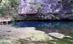
- Fen landform or very poorly drained soils with mucky surface associated with spring discharge, occurring on multiple landforms.
Ecological site map
Basemap
Find me
Find point
Full screen
Zoom in to display soil survey map units for an area of interest, and zoom out to display MLRAs. Select a map unit polygon to view ecological sites correlated to that map unit. View a brief description of an ecological site by clicking on its name in the map popup. Soil survey correlations may not be accurate, and ecological site classification of a location should always be verified in the field. Each selection may require the transfer of several hundred KB of data.
Ecological site keys
Ecological site photos
Print Options
Sections
Font
Other
Briefcase
Add ecological sites and Major Land Resource Areas to your briefcase by clicking on the briefcase (![]() ) icon wherever it occurs. Drag and drop items to reorder. Cookies are used to store briefcase items between browsing sessions. Because of this, the number of items that can be added to your briefcase is limited, and briefcase items added on one device and browser cannot be accessed from another device or browser. Users who do not wish to place cookies on their devices should not use the briefcase tool. Briefcase cookies serve no other purpose than described here and are deleted whenever browsing history is cleared.
) icon wherever it occurs. Drag and drop items to reorder. Cookies are used to store briefcase items between browsing sessions. Because of this, the number of items that can be added to your briefcase is limited, and briefcase items added on one device and browser cannot be accessed from another device or browser. Users who do not wish to place cookies on their devices should not use the briefcase tool. Briefcase cookies serve no other purpose than described here and are deleted whenever browsing history is cleared.
Ecological sites
Major Land Resource Areas
The Ecosystem Dynamics Interpretive Tool is an information system framework developed by the USDA-ARS Jornada Experimental Range, USDA Natural Resources Conservation Service, and New Mexico State University.