
Major Land Resource Area 246X
Arctic Coastal Plain
Accessed: 10/09/2025
Description
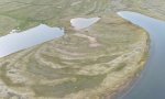
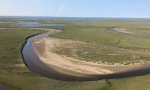
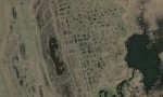
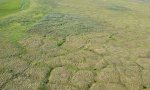
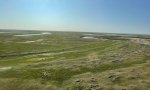
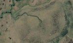
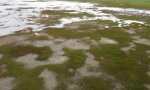
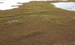
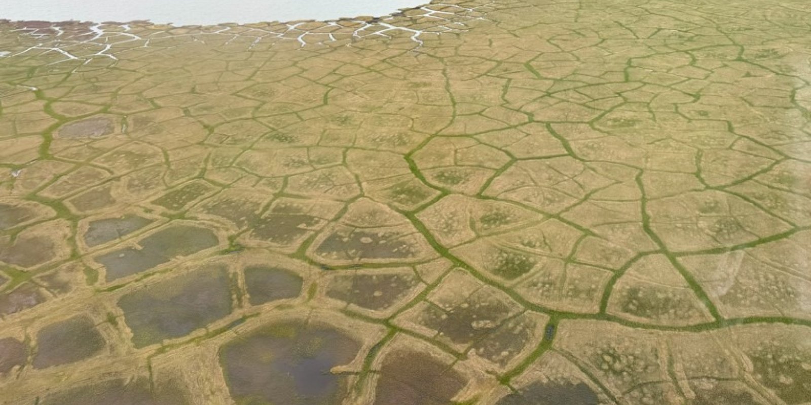
The Arctic Coastal Plain MLRA (MLRA 246X) consists of level to gently rolling plains along the coast of the Arctic Ocean. This area makes up 22,235 square miles. It is mostly remote, sparsely populated wildland. Numerous rivers, mostly originating in the Brooks Range, drain to the Arctic Ocean. The largest being the Canning, Colville, Jago, Kongakut, Kuk, Utukok, and Sagavanirktok Rivers. Narrow, nearly level flood plains and stream terraces parallel the many rivers. The area is dotted by thousands of small and medium-size lakes and interconnecting wetlands. Many of the lakes are elongated thaw lakes, which are consistently oriented from north to northwest. Small sand dunes occur along the coastline, rivers, and plains. Elevation ranges from sea level to about 655 feet. The dominant soil order in this MLRA is Gelisols. Most have an aquic soil moisture regime. The Gelisols are shallow or moderately deep to permafrost, occur on fine and coarse textured sediments, and are generally poorly drained or very poorly drained. Common Gelisol suborders are Histels, Orthels, and Turbels. The Histels have a glacic layer and/or thick accumulations of surface organic material and are associated with ice-wedge troughs of polygons, vegetated lake basins, swales, and low-gradient drainageways. The Orthels and Turbels have comparably thinner surface organic material and occur on flood plains, stream terraces, plains, and the centers of low- and high-center polygons. Miscellaneous (non-soil) areas make up about 20 percent of this MLRA. The most common are water, riverwash, and beaches.
Key publications
Next steps
-
1
Select an ecological site
Select an ecological site using the list, keys, photos, briefcase, or quick search option located on this page. -
2
Explore the ecological site description
Next, learn more about the selected ecological site and its characteristic dynamics by browsing the ecological site description and exploring alternative state and transition model formats.
Ecological site list
-
i
Key Characteristics
- Wetland soils. Any soils that flood, pond, and/or have a water table at very shallow to shallow depth during the growing season (0 to 10 inches). Includes all soils associated with ice-wedge.
- Not as above.
- Not as above, freshwater wetlands.
- Not as above.
- No flooding. Flats and slopes, includes stream terraces.
-
i
Key Characteristics
- Wetland soils. Any soils that flood, pond, and/or have a water table at very shallow to shallow depth during the growing season (0 to 10 inches). Includes all soils associated with ice-wedge.
- Not as above.
- Not as above, freshwater wetlands.
- Not as above.
- Frequent to rare flooding, riparian wetland with channel driven hydrology.
- Mineral soils that lack thick peaty surface layers. Common landforms include floodplains and incised drainageways.
-
i
Key Characteristics
- Wetland soils. Any soils that flood, pond, and/or have a water table at very shallow to shallow depth during the growing season (0 to 10 inches). Includes all soils associated with ice-wedge.
- Soils on landforms that have ice-wedge polygons making a distinct mosaic of vegetation. These vegetation models are ecological site complex.
- Landforms with a mosaic of low- and high-center ice-wedge polygons. Common landforms include stream terraces and relict lakebeds.
-
i
Key Characteristics
- Wetland soils. Any soils that flood, pond, and/or have a water table at very shallow to shallow depth during the growing season (0 to 10 inches). Includes all soils associated with ice-wedge.
- Not as above.
- Not as above, freshwater wetlands.
- Not as above.
- Frequent to rare flooding, riparian wetland with channel driven hydrology.
- Soils are capped with 8 or more inches of peat and mucky peat. Permafrost occurs in the soil profile. Common landforms are swales and low-gradient drainageways.
-
i
Key Characteristics
- Wetland soils. Any soils that flood, pond, and/or have a water table at very shallow to shallow depth during the growing season (0 to 10 inches). Includes all soils associated with ice-wedge.
- Soils on landforms that have ice-wedge polygons making a distinct mosaic of vegetation. These vegetation models are ecological site complex.
- Landforms that predominately have high-center ice-wedge polygons. Common landforms are slopes of plains.
-
i
Key Characteristics
- Not as above. Mesic to dry, non-wetland soils.
- Soils on active and relict dunes, blowouts, and eroded bluffs.
-
i
Key Characteristics
- Wetland soils. Any soils that flood, pond, and/or have a water table at very shallow to shallow depth during the growing season (0 to 10 inches). Includes all soils associated with ice-wedge.
- Not as above.
- Not as above, freshwater wetlands.
- Depressions. Includes recently drained lakebeds and other depressions on floodplains, stream terraces, and plains.
-
i
Key Characteristics
- Wetland soils. Any soils that flood, pond, and/or have a water table at very shallow to shallow depth during the growing season (0 to 10 inches). Includes all soils associated with ice-wedge.
- Not as above.
- Soils on shore complex with tidal flooding (Estuarine Fringe Wetlands)
- Proximal to shore (height/distance); periodic tidal flooding. Common landforms include estuaries, tidal flats, and lower tidal marsh. Permafrost does not typically occur in the soil profile.
-
i
Key Characteristics
- Wetland soils. Any soils that flood, pond, and/or have a water table at very shallow to shallow depth during the growing season (0 to 10 inches). Includes all soils associated with ice-wedge.
- Not as above.
- Soils on shore complex with tidal flooding (Estuarine Fringe Wetlands)
- Distal to shore (height/distance); sporadic tidal flooding. Common landforms include backshores and upper tidal marsh. Permafrost occurs in the soil profile.
Ecological site map
Basemap


Find me
Find point
Full screen
Zoom in to display soil survey map units for an area of interest, and zoom out to display MLRAs. Select a map unit polygon to view ecological sites correlated to that map unit. View a brief description of an ecological site by clicking on its name in the map popup. Soil survey correlations may not be accurate, and ecological site classification of a location should always be verified in the field. Each selection may require the transfer of several hundred KB of data.
Ecological site keys
Ecological site photos
Print Options
Sections
Font
Other
Briefcase
Add ecological sites and Major Land Resource Areas to your briefcase by clicking on the briefcase () icon wherever it occurs. Drag and drop items to reorder. Cookies are used to store briefcase items between browsing sessions. Because of this, the number of items that can be added to your briefcase is limited, and briefcase items added on one device and browser cannot be accessed from another device or browser. Users who do not wish to place cookies on their devices should not use the briefcase tool. Briefcase cookies serve no other purpose than described here and are deleted whenever browsing history is cleared.
Ecological sites
Major Land Resource Areas
The Ecosystem Dynamics Interpretive Tool is an information system framework developed by the USDA-ARS Jornada Experimental Range, USDA Natural Resources Conservation Service, and New Mexico State University.